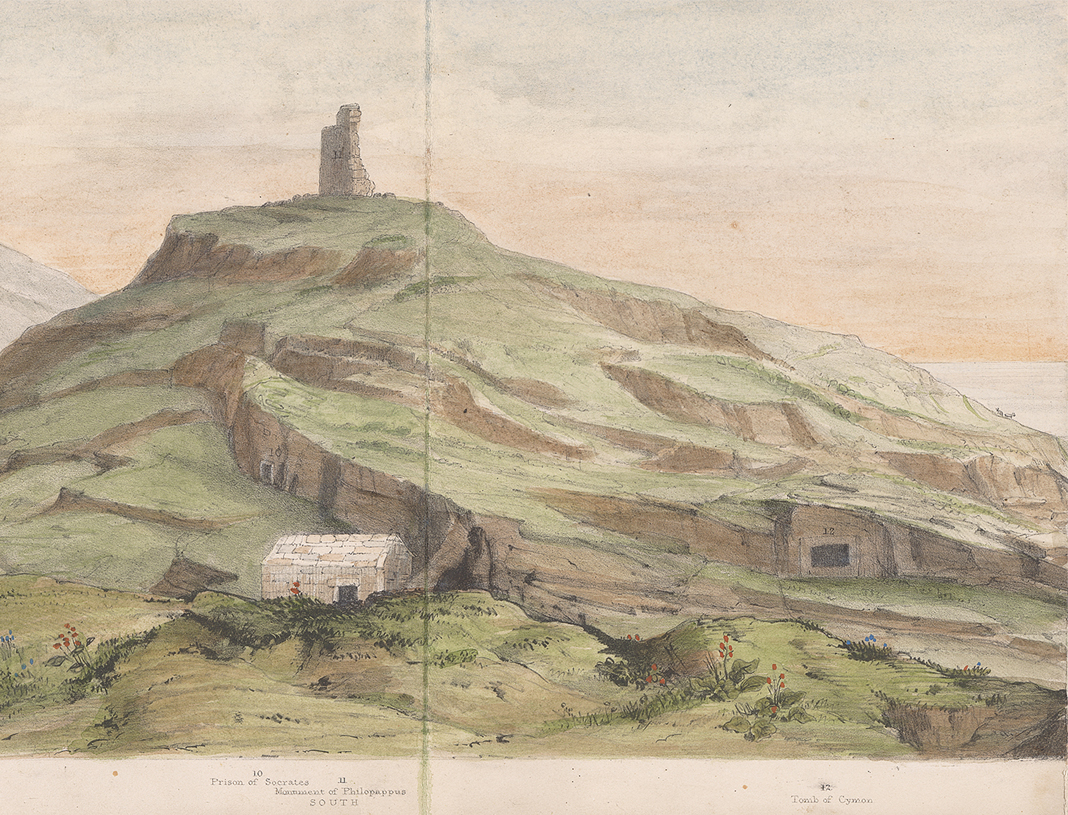
The Western Hills have been incorporated from the outset into the urban environment of Athens and have since been the focus of a variety of interventions, such as stone extraction, landscaping and afforestation, individual or collective appropriation, and visual arts.
The project consists in collecting and processing archival material for studying the morphology of the Hills, focusing on the archaeological remains, the road network and the constantly changing topography. The study attempts to enrich the published material with new elements so as to contribute to the reconstruction of the morphology of the Hills as far back as possible in antiquity.
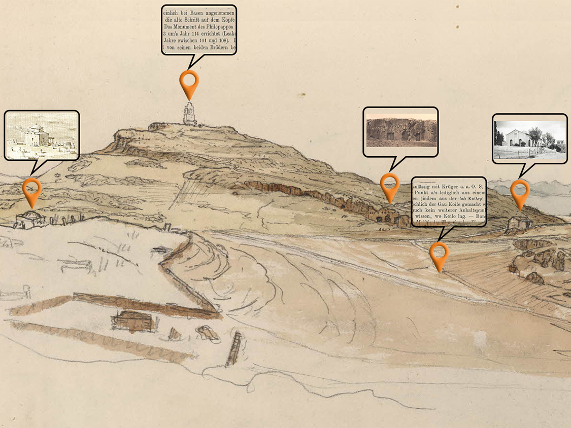
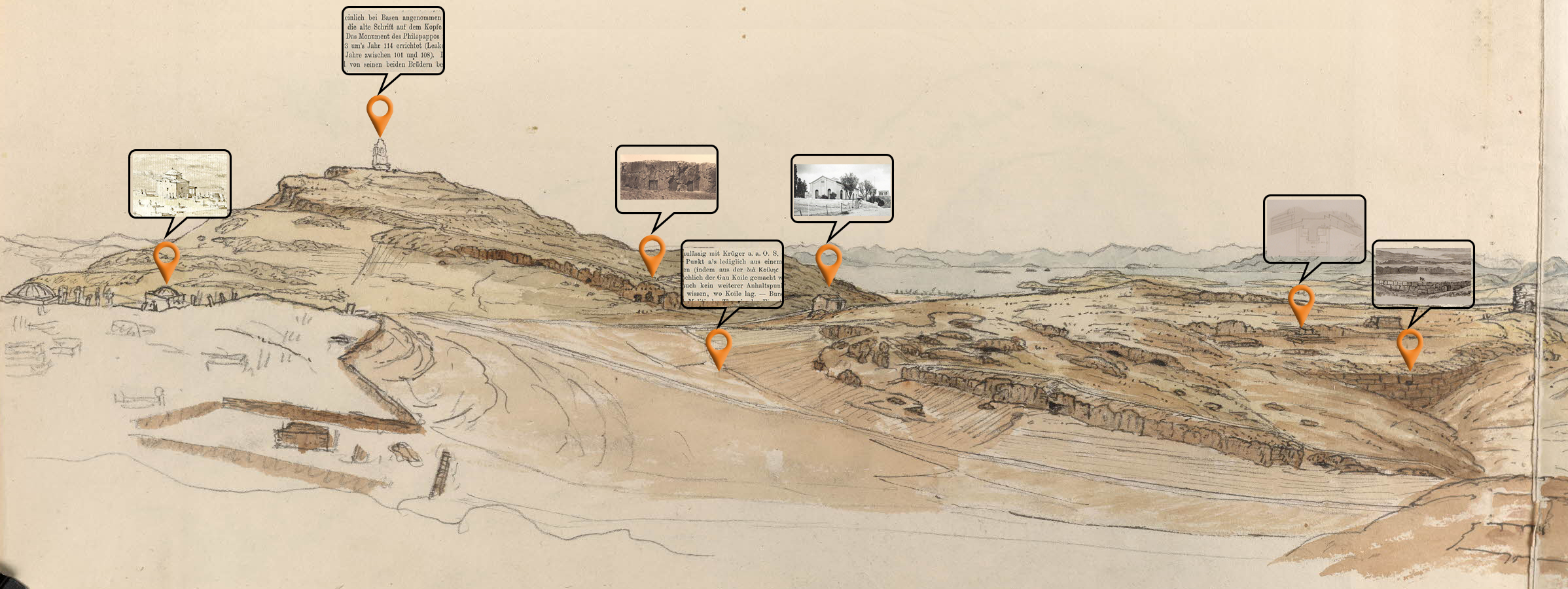
Utilizing the benefits of GIS, we will make sure that the diverse collection of materials (maps, excavations, photos, sketches, etc.) can be placed in space and time, and published on the internet with the help of web-mapping. We hope it will be a useful tool for studying and highlighting the Western Hills of Athens.
Since January 2018, with the kind support of the John S. Latsis Public Benefit Foundation, we have been carrying out a study entitled "Development of a methodology for the documentation of archaeological sites in the urban environment: Recording and simulation of the historical transformations of the Philopappou hill in Athens".
The digital resources that will be created within the project will be openly made available to the public and any cultural management body.